Copenhagen Airport (CPH)
City Orientation and Maps
(Copenhagen, Denmark)
Copenhagen is the biggest of all the cities in Scandinavia and is known locally as 'København'. The city is a particularly lively spot and despite its overall size and sprawl, Copenhagen features many attractive areas, with mainly low-rise buildings and architecture. Copenhagen's skyline is dominated by a mixture of old and new, including a number of prominent local churches.
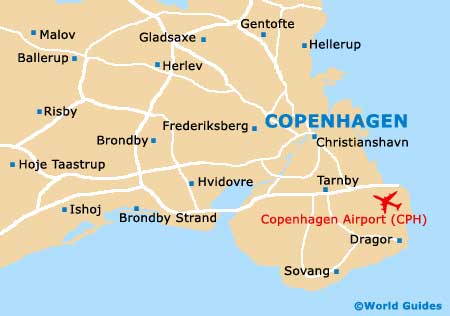
Denmark's capital city for around 600 years, Copenhagen has grown dramatically over the years. The arrival of Copenhagen Airport (CPH) in 1925, on the island of Amager, heralded the city's expansion plans and although initially only a small, private airport, by the mid-20th century, more than one million passengers were passing through the gates. At this time, Copenhagen Airport won a prestigious award, ranking it as the best airport in the whole world.
Copenhagen Airport (CPH) Maps: Important City Districts
Copenhagen may be a large city, but it is simple to find your way around, with organised districts and a number of large parklands, public squares and pleasant fountains. Much of the city is easily walkable and features prominent shopping districts, which are well pedestrianised. Also worth noting, Copenhagen contains a superb network of cycle lanes.
Central Station (Hovedbanegarden) can be found on the western side of the hotel district and is close to the Tivoli amusement park. The main bus station is also located nearby in this part of Copenhagen. Strøget is a major pedestrian mall, dissecting the city centre and sited near to the Nyhavn Canal, with a range of shops and restaurants never far away.
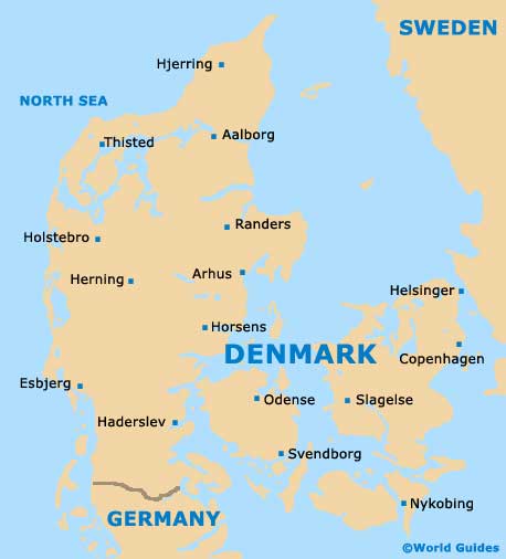
Denmark Map
Copenhagen Map